Cyclone Arnab’s come ashore near Yanam-Kakinada, rain’s really coming down hard across the east
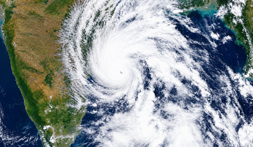
Cyclone Arnab made landfall a little while ago, somewhere between 2 and 4 this morning, right around the Yanam-Kakinada stretch. Winds were sitting at 125 to 135 kmph and gusting up to 150 when it crossed. By now a lot of people in those coastal towns must be hearing the rain hammering the roofs and the wind still pushing at the windows. IMD had been saying all day Tuesday that it was getting closer faster than they first expected. By late evening the centre was only about 70 km south-southeast of Kakinada and already starting to feel the land. That’s why the landfall time moved earlier. Once these things hit land they usually start losing strength pretty quick, but the rain they bring can hang around and spread quite a bit further inland. Andhra’s taking the first proper hit. The northern districts — Visakhapatnam, Vizianagaram, Anakapalli, Srikakulam, Kakinada, East and West Godavari — already got proper heavy rain on Tuesday. One place in Visakhapatnam rural recorded more than 140 mm in a day. Trees are down all over the city, power lines have snapped in a few spots, and the low-lying areas are filling up. One person died, a 65-year-old man in Mangalapalem who touched a live wire that had fallen into water. The Chief Minister said they’ve shifted over 84,000 people into 290 shelters and every fishing boat is safely back. Odisha’s next. Southern districts like Ganjam, Gajapati, Rayagada, Malkangiri, Koraput and Nabarangpur are under the stronger alerts. Teams have been moving people out of the riskier coastal and low-lying spots. Schools are shut, no one’s going out to fish, and the disaster teams are ready. They’re looking at heavy to extremely heavy rain through today and into Thursday as the system drifts inland. The rain won’t stop at the coast either. Chhattisgarh, eastern Telangana, bits of Vidarbha, East Madhya Pradesh, Jharkhand and even some places in Bihar and Gangetic West Bengal are going to see solid showers as it moves north and northeast. Isolated extremely heavy falls are still possible over coastal Andhra, Odisha and Chhattisgarh today. Farmers have been told to harvest whatever’s ready and keep it safe. Rivers and drains along the coast are being watched because of that one-to-two-metre surge that was expected around Kakinada and Yanam. Travel’s a mess. Dozens of trains on the Vijayawada–Visakhapatnam–Kakinada route were cancelled or delayed. Flights out of Visakhapatnam got disrupted and today’s schedule looks uncertain. Ports put up the highest danger signals. Beaches from Visakhapatnam down to Kakinada stayed closed and the sea was really rough in the hours before landfall. What feels different this time is how early everyone got ready. People were moved well before the worst winds arrived. Fishermen came back safe. Control rooms at district and mandal level stayed open through the night. That preparation is going to matter over the next couple of days because even after the wind drops the water will keep coming. Waterlogging, blocked roads and power cuts are almost certain in the worst-hit spots. Right now the main worry is that stretch of coast from Bapatla up to Visakhapatnam and the adjoining southern Odisha districts. Relief teams are already on the move and the power and road crews are waiting for the winds to ease so they can start fixing things. People in the shelters are being looked after, and the next few IMD updates will tell us how fast the system weakens and how far the rain spreads. If you’re in any of the alerted districts, stay indoors if you can, keep checking the local messages, and stay away from low-lying or flood-prone areas until they say it’s okay. The cyclone has made landfall, but the rain is still very much going on. Sources: IMD bulletins and coastal warnings from 27-28 October 2026, The Hindu reports from Vijayawada and Visakhapatnam, India Today and Indian Express live coverage, Andhra Pradesh and Odisha disaster management updates. @Rohit Manral
Monsoon Tracker LIVE: That depression over the Bay of Bengal is turning into a cyclonic storm by tomorrow
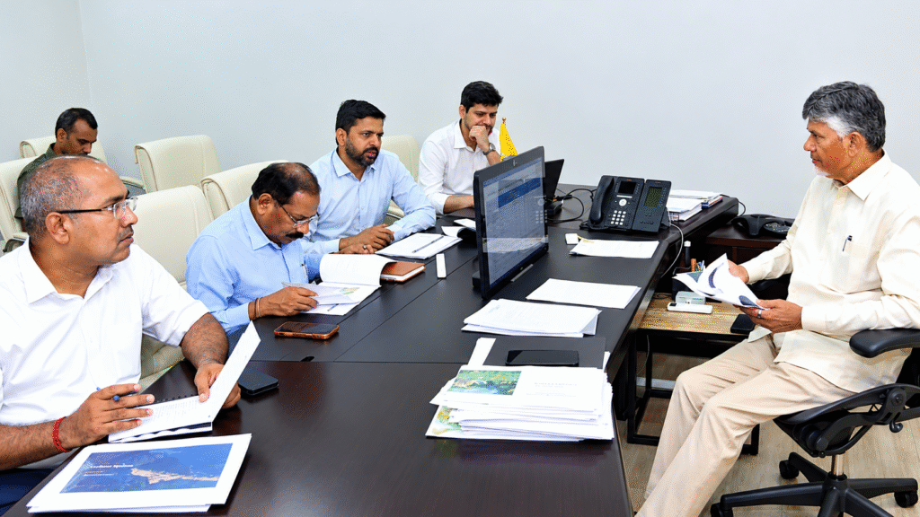
As of this afternoon, Sunday the 25th, the depression sitting over the east-central and southeast Bay of Bengal has already strengthened into a deep depression. IMD says it’s very likely to become a full cyclonic storm by early Monday morning, the 26th. Right now it’s centred somewhere around 15.1°N and 91.0°E — roughly 420 km north-northwest of Sri Vijaya Puram in the Andamans and about 870 km east-southeast of Visakhapatnam. It’s been crawling southwest at around 5 kmph. They expect it to keep moving that way a bit longer, pick up more strength, then slowly curve west-northwest. By Monday morning it should be a cyclonic storm. Then it looks set to keep intensifying — severe by Tuesday morning, and possibly a very severe cyclonic storm as it gets closer to the coast. Current track points to it crossing the Andhra Pradesh and Yanam coast somewhere between Bapatla and Visakhapatnam around the forenoon of the 28th, with winds of 115-125 kmph, gusting up to 140 kmph. That’s the picture for now. These systems can still shift a little, so keep an eye on the official updates. Winds over that part of the Bay are already getting squally and will get stronger. Gale winds of 70-80 kmph, gusting to 90, are expected from early Monday. Seas will turn very rough to high, which is why fishermen have been told to stay off the water. Several ports in Tamil Nadu and Puducherry have already put up cyclone warning signals — Chennai, Nagapattinam, Cuddalore and a few others. Andhra and south Odisha coasts are under a cyclone alert. Rain is going to be the other big thing. Coastal Andhra is likely to get heavy to very heavy rain at many places, with some extremely heavy spells on the 27th and 28th. Odisha should see similar amounts around the same time. Even parts of coastal West Bengal and neighbouring areas could pick up heavy rain as the system moves inland. If you’re along the Andhra or south Odisha coast, this is the time to stay alert. Strong winds, rough seas, possible local flooding and waterlogging are all on the cards once the heavy rain arrives. Fishermen and anyone with boats or offshore work need to follow the stay-ashore advice strictly. IMD is putting out regular bulletins, so stick to those rather than random forwards. Keep your phone charged, secure anything loose around the house, and stock a few essentials if you’re in the likely affected districts. Local authorities will keep issuing their own advisories as things develop. It’s a typical late-season Bay system — warm water is still there and the atmosphere is allowing it to organise. How fast it strengthens and the exact path it takes will decide the final impact, but the current guidance is clear enough: a strong cyclone is heading towards the Andhra coast by the 28th. Stay safe out there, keep checking the official updates, and don’t take the sea lightly over the next few days. Sources:IMD special bulletins and tropical weather outlooks dated 25 October 2026, IMD’s official updates, and reports based on their briefings from ANI, Business Standard and Hindustan Times. @Rohit Manral